Loading…
The Cape Wrath Trail
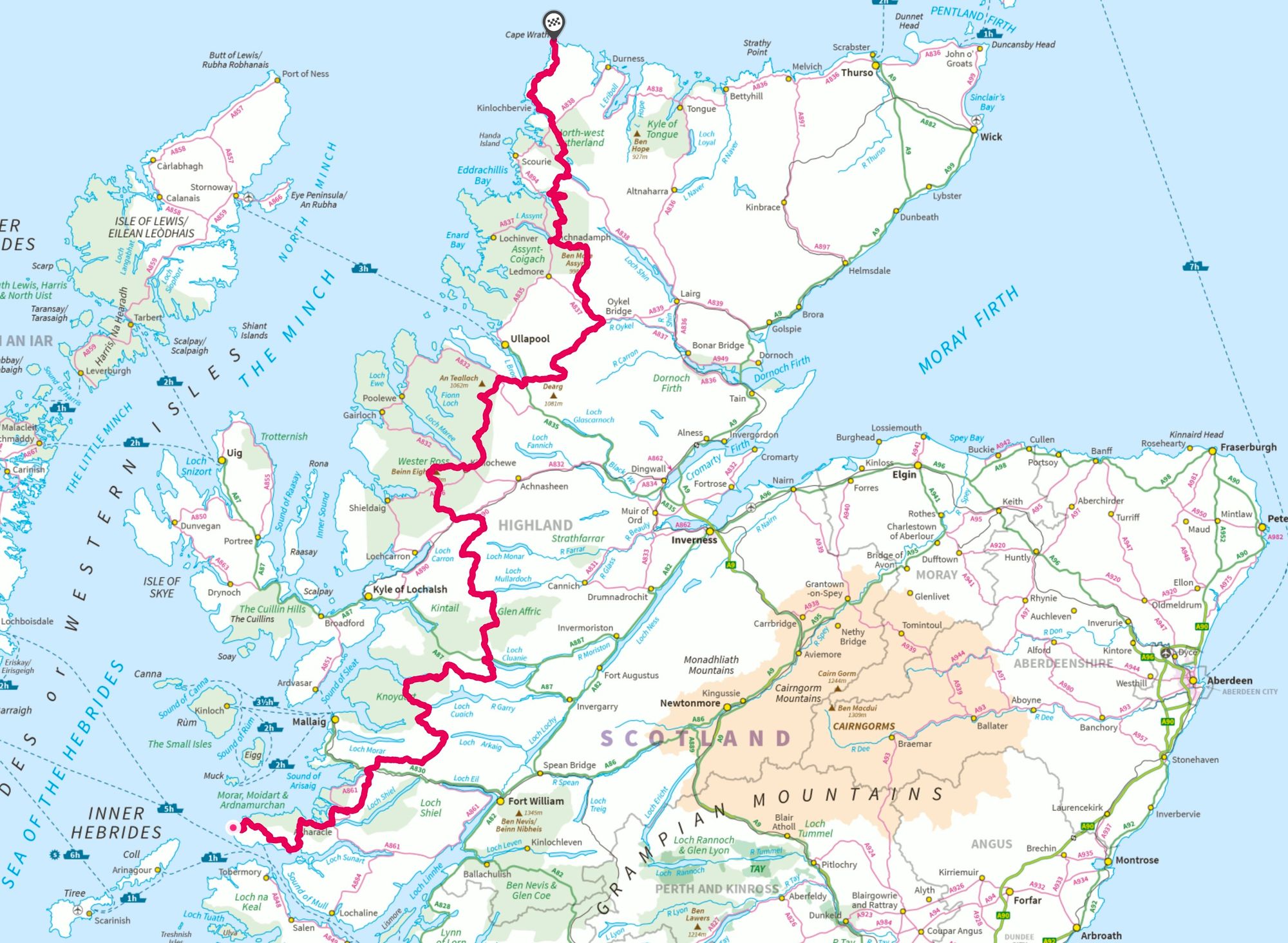
The Cape Wrath Trail is an unofficial, unmarked and magnificently wild long distance route from Fort William to Cape Wrath, the most north westerly point of mainland Scotland. A superb and challenging route for experienced long-distance backpackers, the Trail passes through some of Scotland's most spectacular landscapes.
Dating even farther back into prehistory, the diverse and thriving nature as well as varied geology of the area, attracted our prehistoric ancestors to build settlements here. In this corner of the globe, the natural landscape in Cape Wrath is best left to speak for itself. The sheer magnitude of strikingly breathtaking scenery, quite literally speaking, will at times take your breath away and knock your socks off. You will be left dumbfounded at the spectacle that is the harmony of the universe at work around you.